Black Hills Principal Meridian
This corner was originally surveyed on June 30th, 1877 and was set as the 69 Mile post along the Wyoming – Dakota Territorial Boundary by Rollins J. Reeves. It was not until August 13th, 1878 that U.S. Deputy Surveyor Charles Scott chose the 69th Mile post to be the initial point for the Black Hills Meridian and Baseline. He found the 6 inch square pine post set in the previous year and used this corner to begin laying out the baseline and meridian lines.
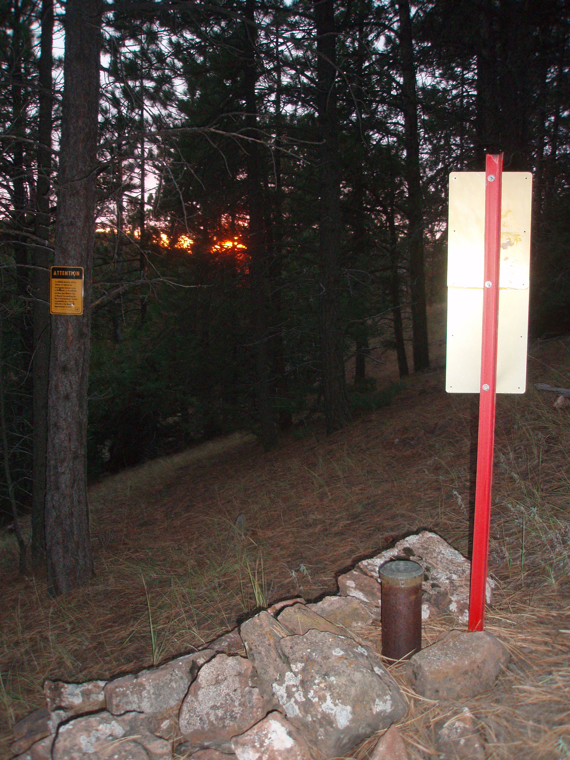
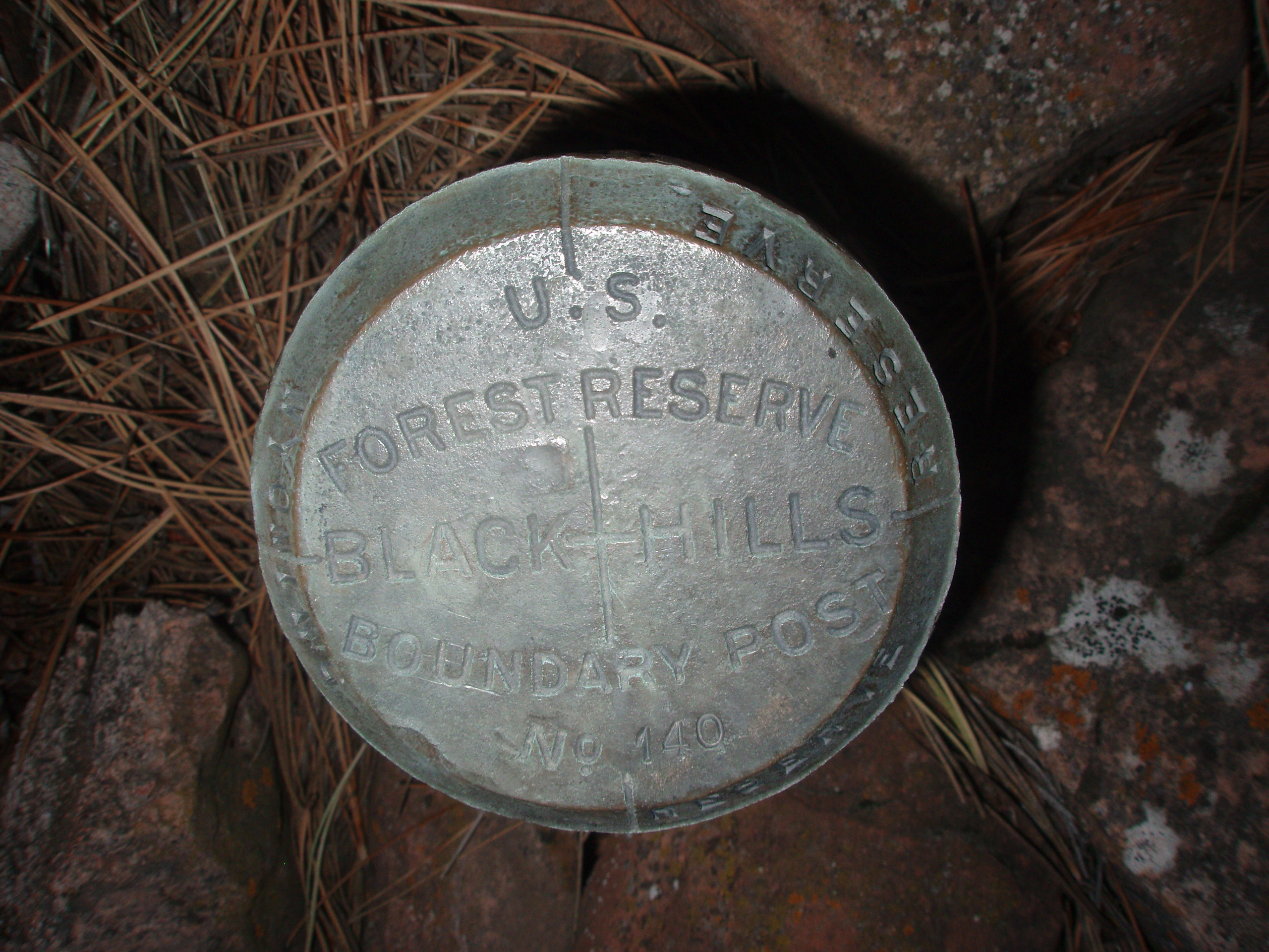
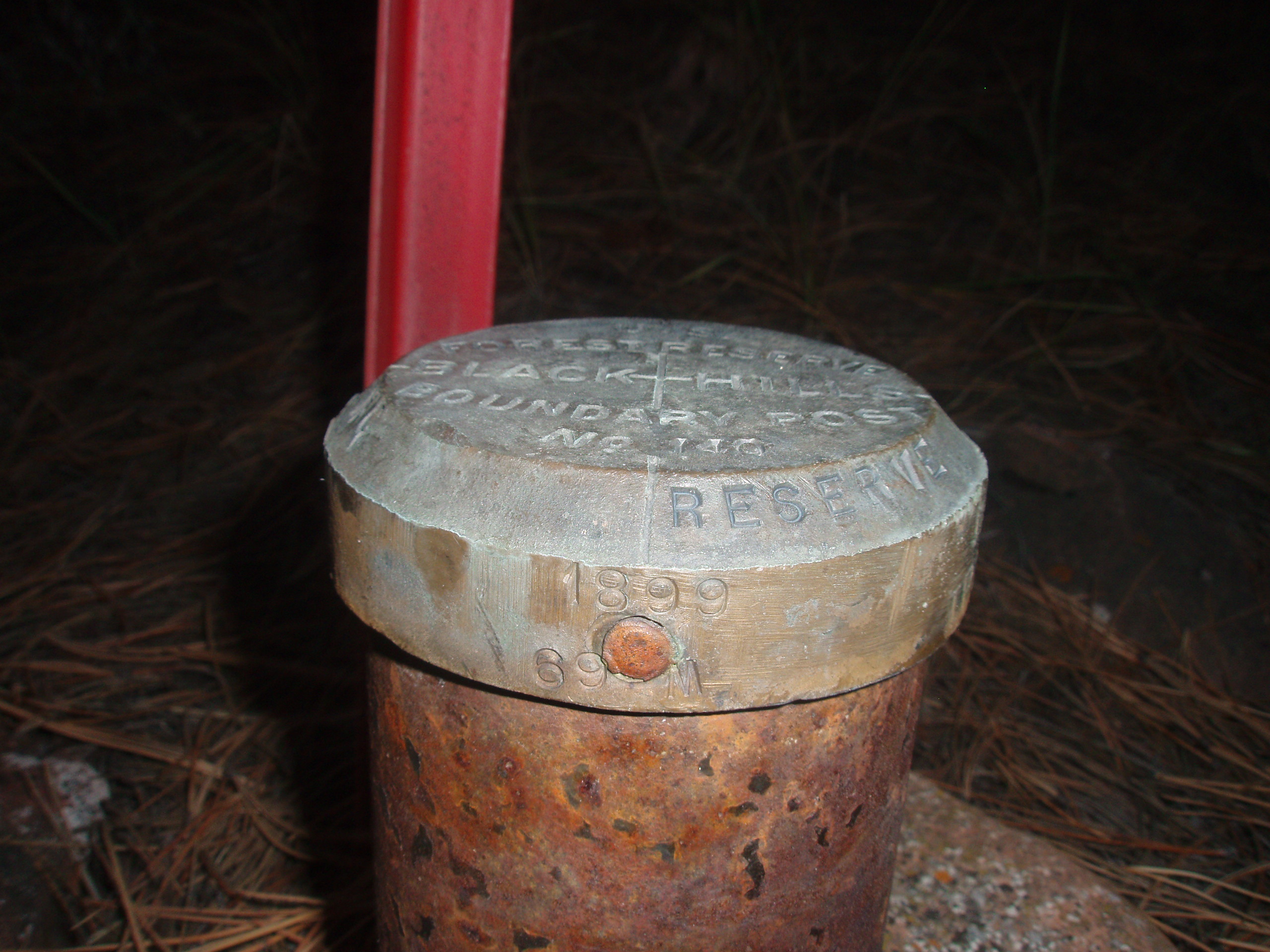
On February 22, 1897, President Grover Cleveland made a proclamation to create the Black Hills Forest Reserve. In 1899, U.S. Surveyor William H. Thorn was assigned to run the boundary for this Black Hills Forest Reserve. On September 28, 1899, Thorn finds the existing wood post and replaces it with a 4 foot steel pipe with a 4 inch brass cap on top. It was marked as Post Number 140 and 69M 1899.
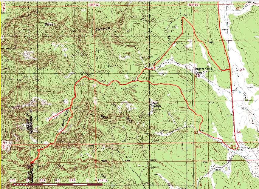
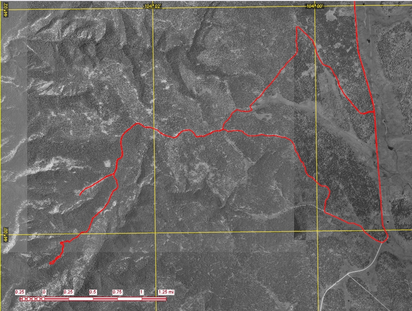
This corner is located approximately 24 graveled miles south of state highway 85 along the Boles Canyon Road (Forest Highway 117) with the last 5 miles being up forest road 113. The final 1.4 miles is along a nearly lost 2-track trail and should only be done on foot or by a high clearance 4-wheel drive vehicle, with the final 0.3 mile down along a timbered slope.
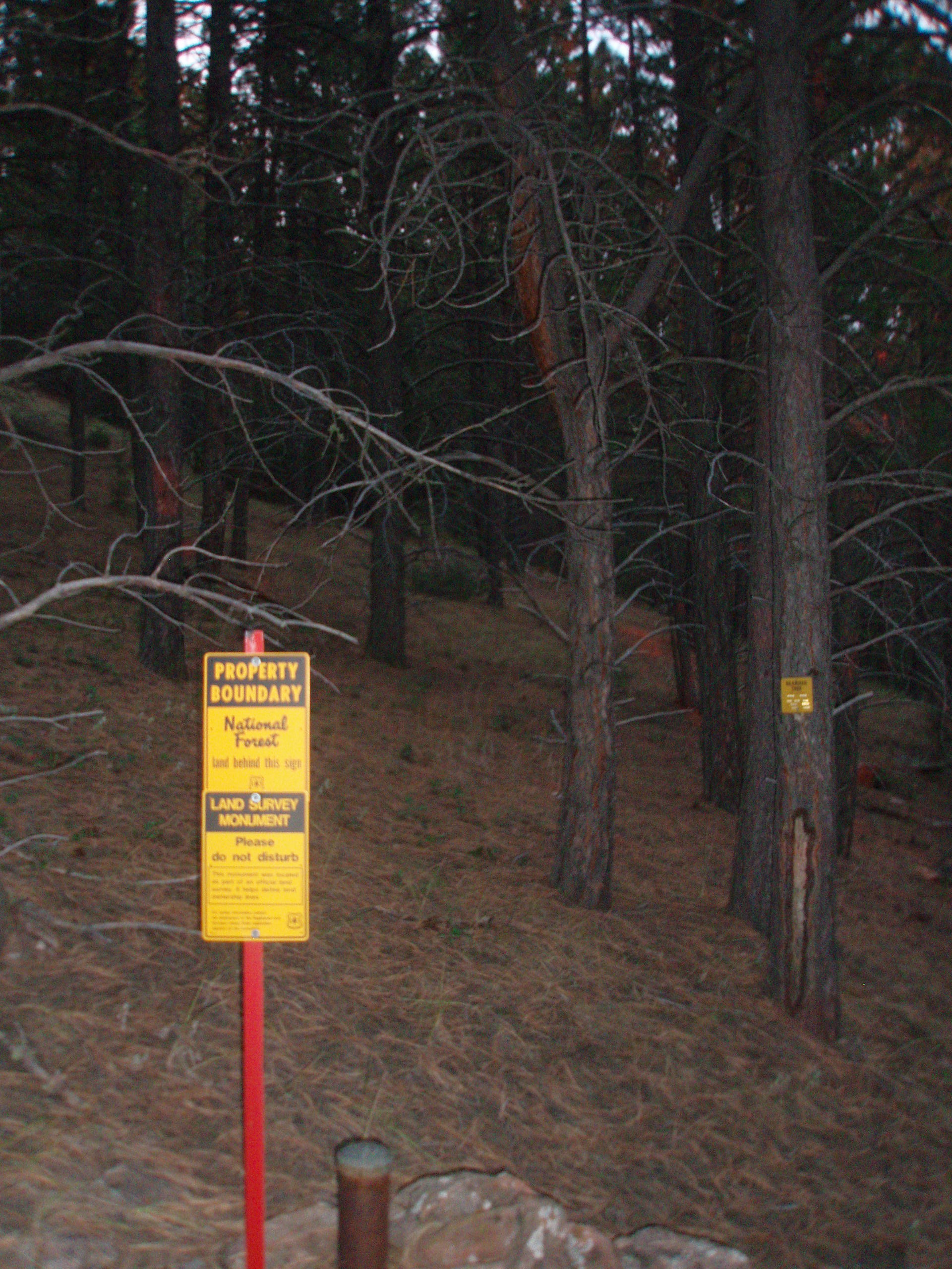
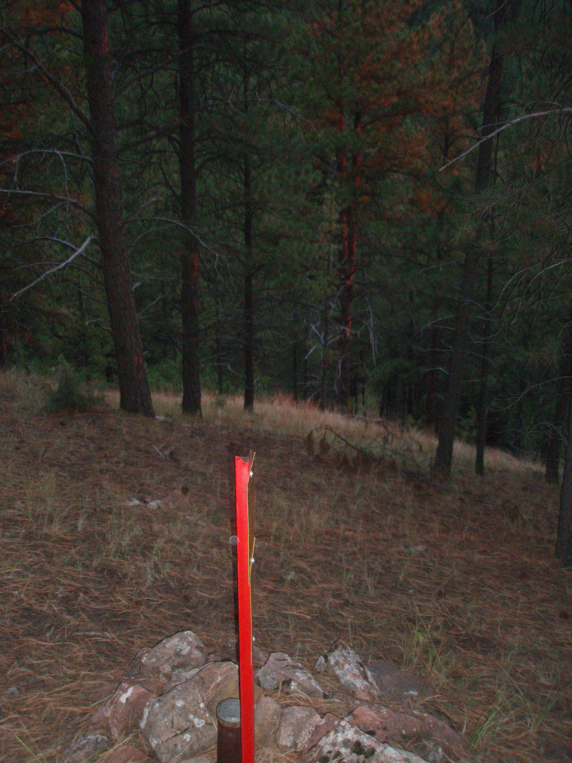
The brass cap and pipe is located on a timbered southwesterly facing slope and is surrounded by a mound of rock, with a red steel angle-iron post with Forest Service Survey signs attached approximately 0.5’ north.
Submitted by:
Kurt A Luebke