The New Mexico Principal Meridian

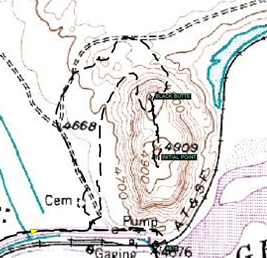
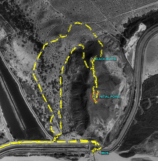
Near San Acacia, New Mexico

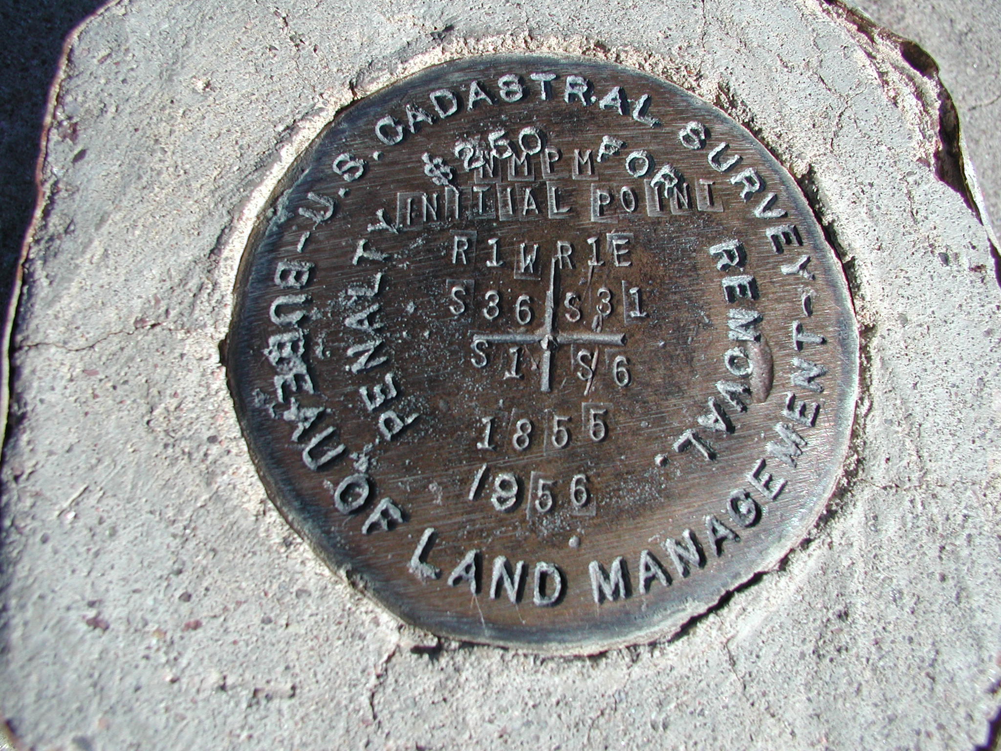
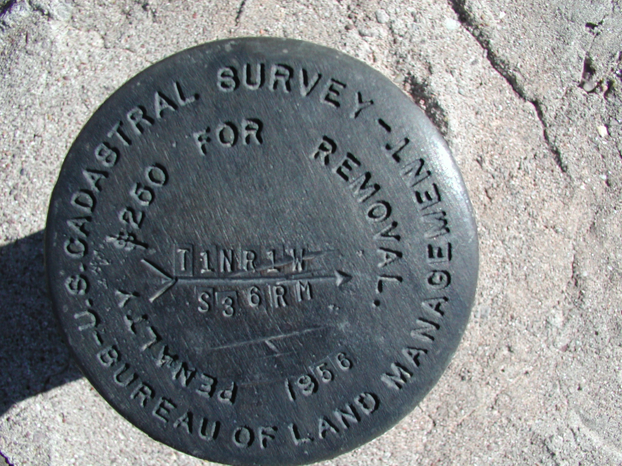
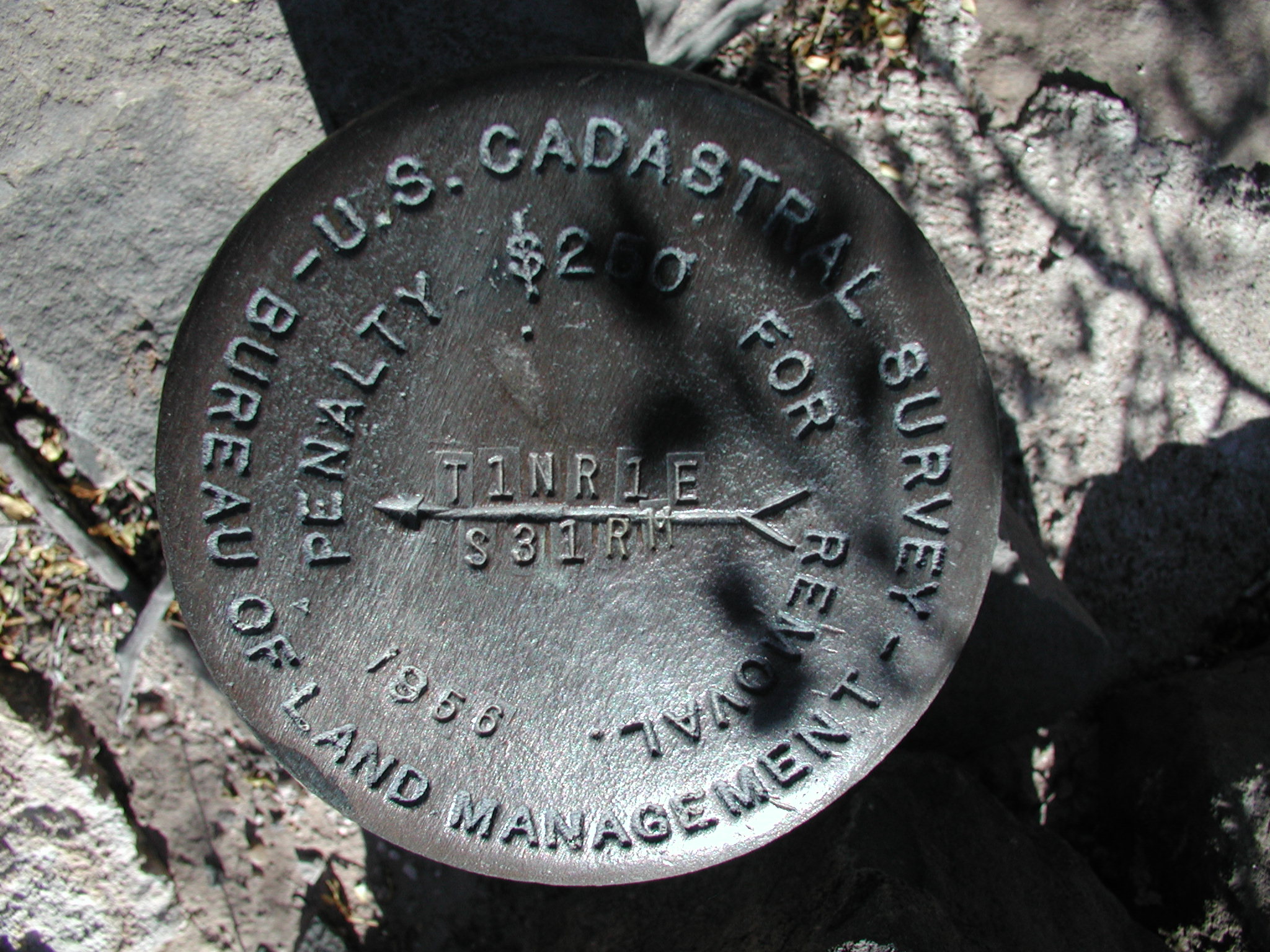
John W. Garretson originally set the New Mexico Principal Meridian in April of 1855.  This Initial Point is the reference for surveys throughout all of New Mexico and the southwest corner of Colorado.  In 1956 there were questions as to the location for the initial point location; the BLM director had the point located, verified and remonumented.

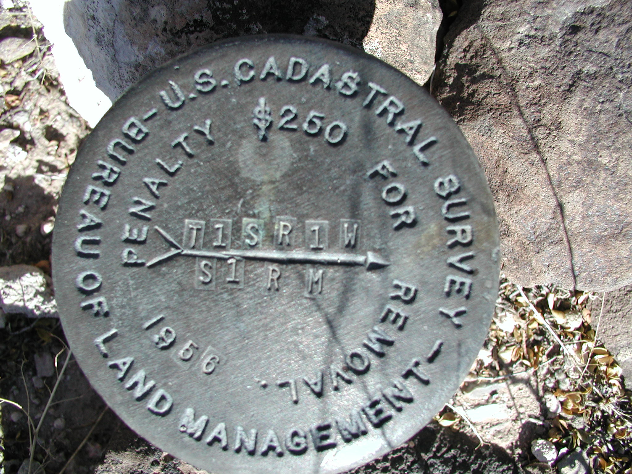
The corner is a 3 ¼” brass cap set in concrete surrounded by a metal container, which is raised approximately 4” above a larger mass of concrete.  There are standard BLM caps in the NE, SE, SW and NW quadrants at varying distances.  All reference monuments are stamped with the bearing and distance to the corner and 1956.  The initial point and the reference monuments are all in very good condition.


Home Page

Submitted by:

Kurt A Luebke
Buckner
M. Creel V


The 4 reference markers above pinpoint the exact location of the initial point.


The initial point falls on a bare mesa approximately 1 mile northeast from the interstate exit for San Acacia, New Mexico.  The corner can be reached by parking at a cemetery at the southwest base of the mesa to the east of San Acacia.  From the cemetery hike northeast along a fence toward a saddle at the northwest side of the mesa for approximately 0.4 mile, then turn southeast and hike up an old trail along the west face of the mesa and then across the mesa for approximately 0.3 mile to the corner on the southerly end of the bald mesa.

This corner has a demanding view in all directions and looks out upon the Rio Grande River.  The hike takes approximately 30 minutes and does not require a lot of exertion.  Great care must be exercised to avoid rattlesnakes in this area.