|
During the years surrounding 1990, my friend Ted
Elzinga hiked virtually all of the trails on Mt. San Bernardino and the
surrounding mountains. At least one of those trips took him to the
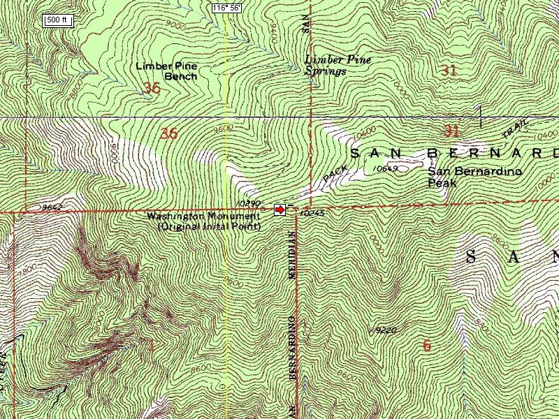
Washington Monument and he took the pictures first displayed on this
webpage.
During 2005 and early 2006 I yearned to document
this, the only original and hardest to reach Initial Point in the United
States. A few trips to Southern California during that time led me
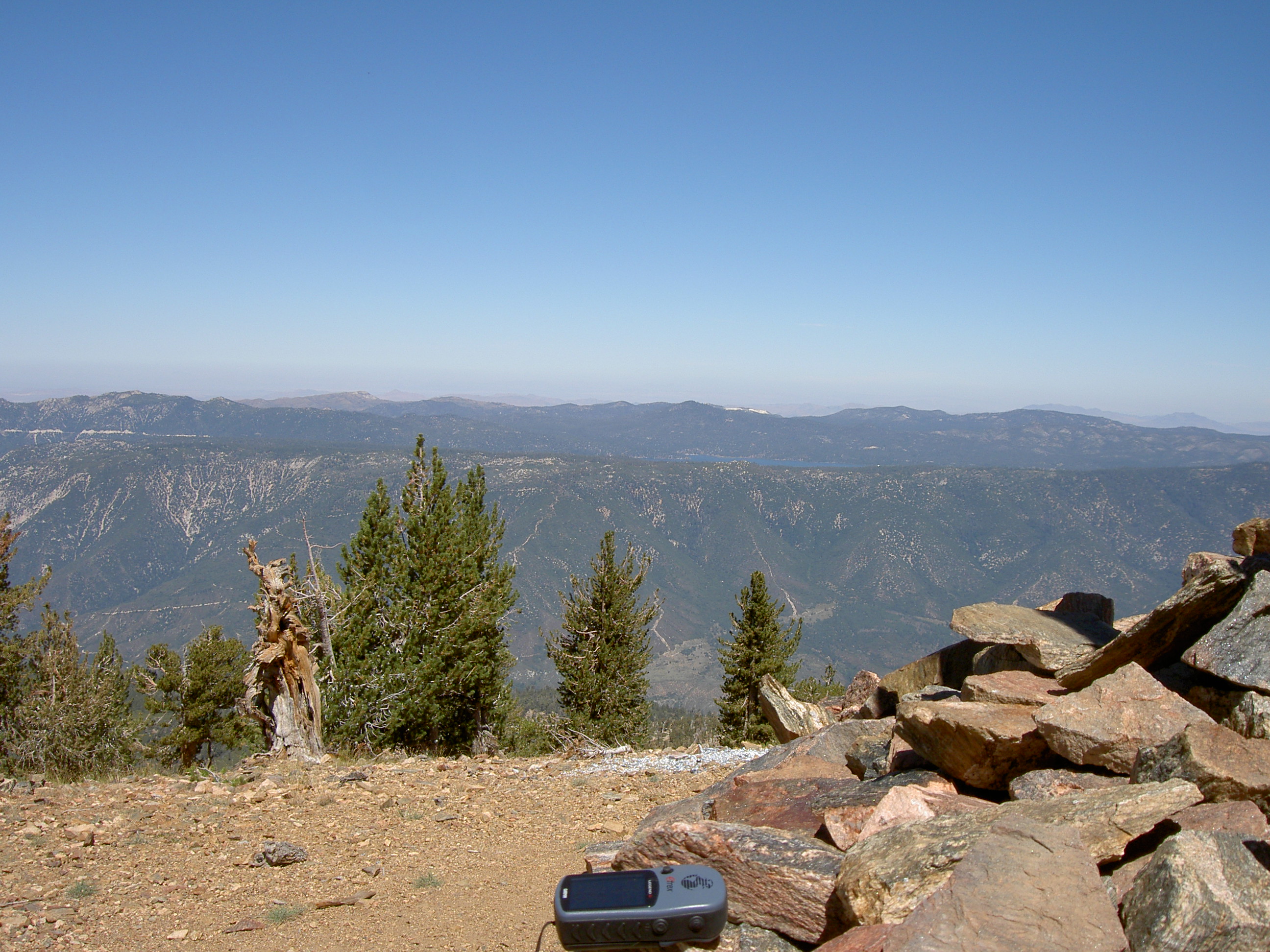
through the valley below that gave me only a hint of how remote the
location is albeit it obscured by 21st Century additions to
the atmosphere.
During a conference in early 2006 that both Ted and
I attended, I struck up a conversation with my riddle about how the
North-South streets near my home in Phoenix, Arizona all jog when
crossing Baseline Road. His response clearly showed his knowledge of
the subject and his prior hike to the monument. We made plans for me to
hike it on Friday, May 5 and he offered his extra room for me to use the
night before. Since he lives just 30 minutes from the trailhead this
was a real benefit.
During the intervening weeks, the temperatures in
Phoenix reached and surpassed 90 degrees (F), yet I was able to practice
on the mountains in our parks. That completely blinded me to what
conditions I would actually find on top of Mt San Bernardino.
On May 5, Ted and I got about 4AM, bought
breakfast, and then headed for the trail head at 5900ft elevation. We
began to hike not long after dawn, but Ted never planned to go the whole
distance. About three hours later, I was up to 8400ft and ran into
show. First it was just thin patches that I could step around or
through. Soon I realized the snow cover was solid above me and I could
not see the trail. Although I was wearing good hiking boots that were
not affected by moisture, each step required far too much effort and had
the risk of an accident that would leave me stranded alone. I turned
around and returned to my car.
All was not lost however. I had learned the lay of
the land and how to use the hand-help GPS unit I had purchased the night
before. Most importantly, the folks at the Mill Creek Ranger Station
gave me a reprint of a paper published in the California Surveyor.
Three Monuments, One Initial Point by Michael A. Duffy, PLS, the
principle surveyor for the Metropolitan Water District, the
Quasi-governmental supplier of water to millions of Californians.
The reprint included an email address for Mike, so
I contacted him and explained the Principal Meridian Project and its
website. I also mentioned my intent to complete my hike to the
Washington Monument. He very graciously offered an electronic copy of
the paper and the chance to accompany him and a group of his staff
surveyors to the monument the following July 15. I eagerly accepted.
I continued to train in the Arizona summer. I
rented a satellite phone so we could talk to the rest of the world from
the mountain. Just before July 15, a wildfire broke out about ten miles
east of the monument. The entire San Gorgonio Wilderness was closed to
the public.
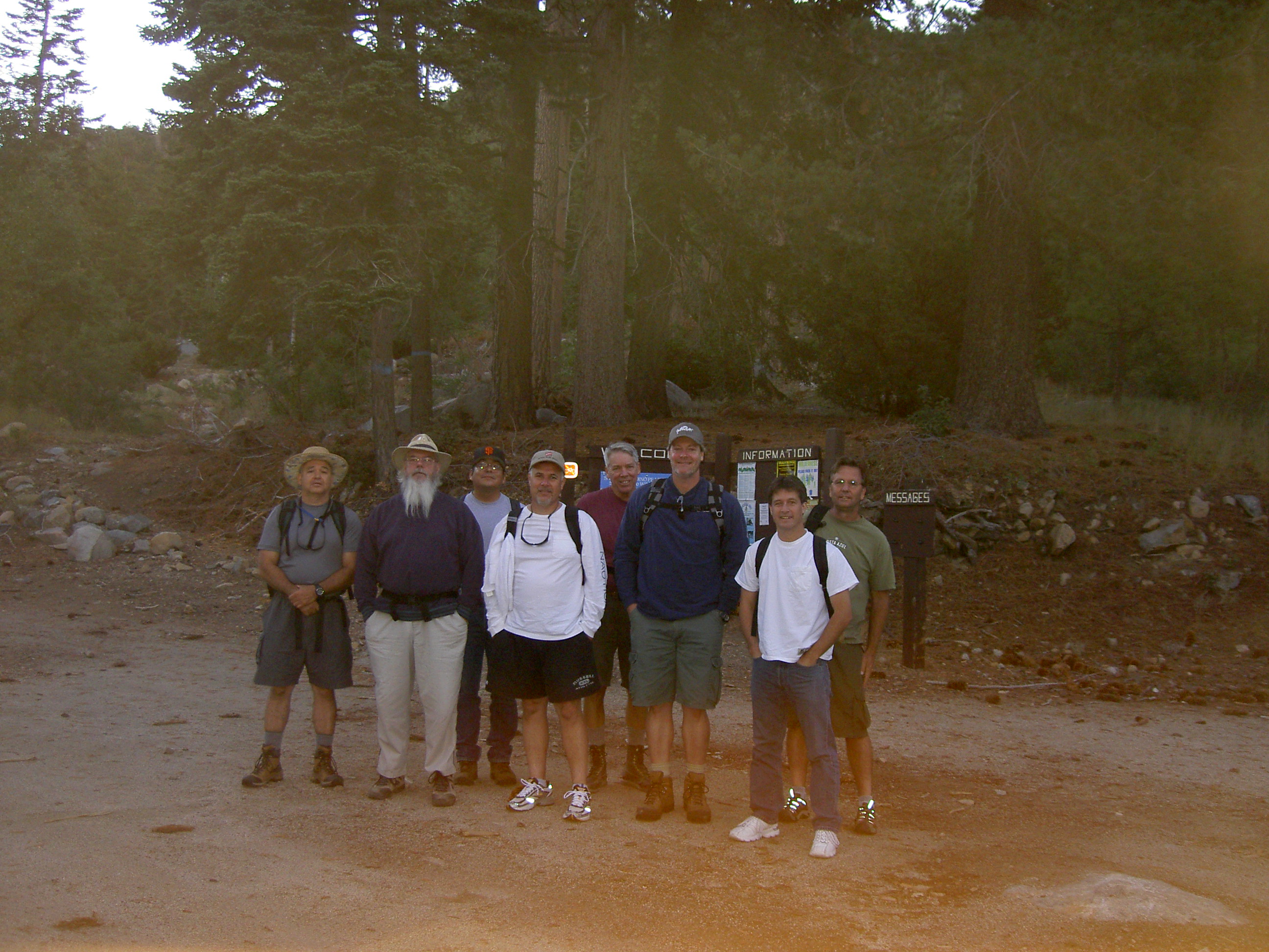
Mike and his staff picked September 9 as the next
try. I continued to train in the Arizona summer. Ted again provided a
place to sleep the night before, but since I would be with others did
not hike. Although we were together at the trailhead, the nine of us
very quickly found our individual paces, not surprising in that I
calculated the grade to be 12% for the first mail and a half, but with
steeper and nearly level portions thereafter. We regrouped a number of
times on the trail, but most of us were at the monument within five
hours.
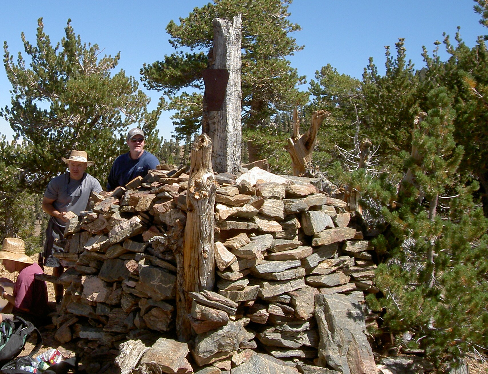
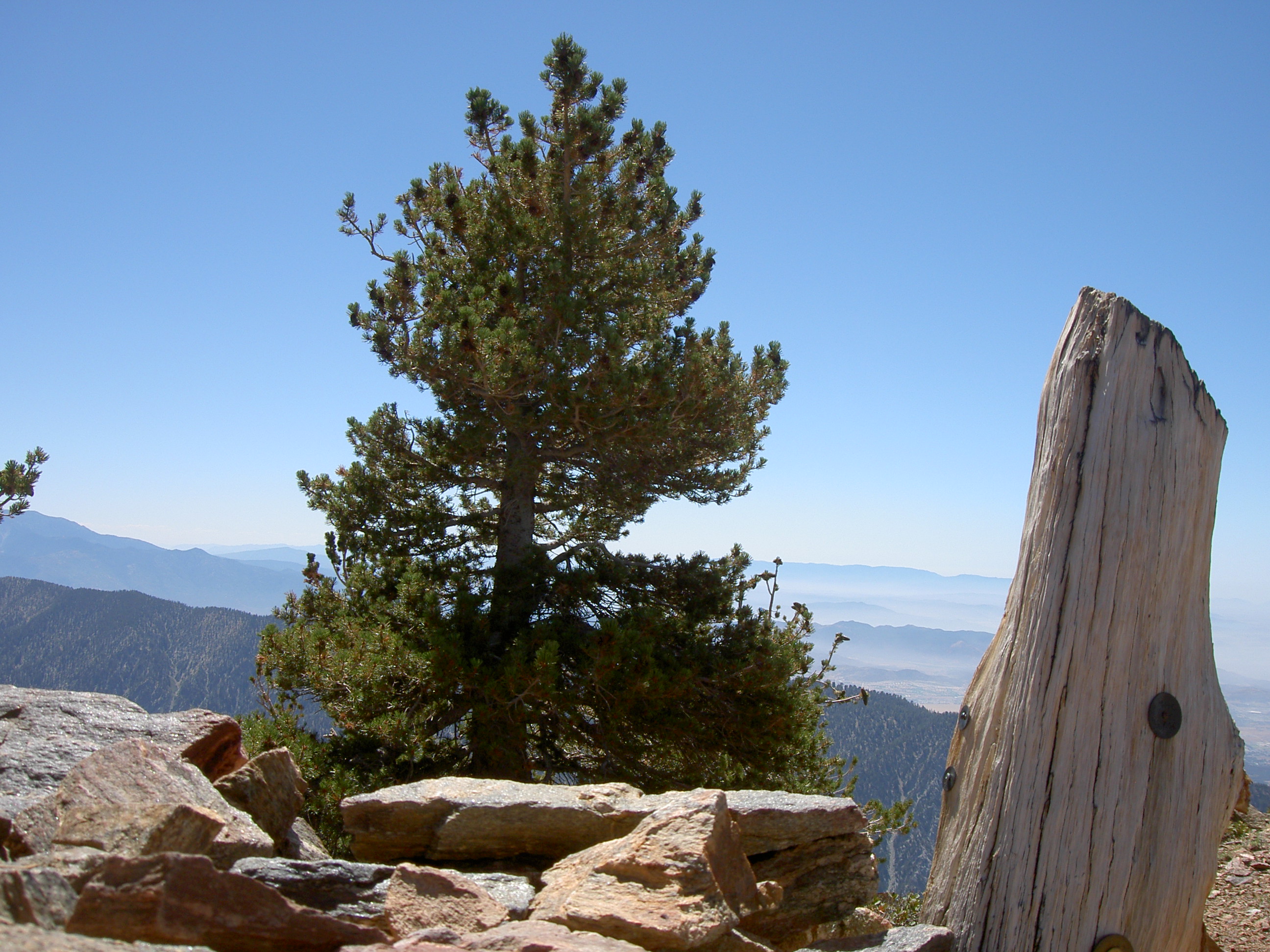
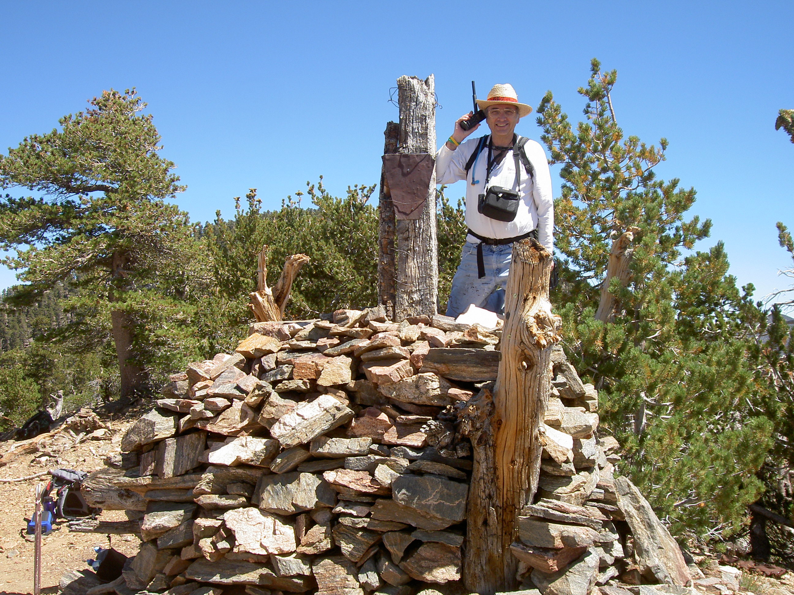
Mike explained that the monument had been
stabilized by rebuilding the rock pile that holds the tall pole. Epoxy
was used to hold rocks together. The original poll is still used,
although is only about half its original height. One of the shinny
reflectors that originally hung from a crossbar is nailed to the pole
and it is severely rusted. Two or three piles of ashes from magnesium
fires that were set to celebrate the 100th anniversary of the
1849 California Gold Rush were clearly visible, each a few feet from the
monument.
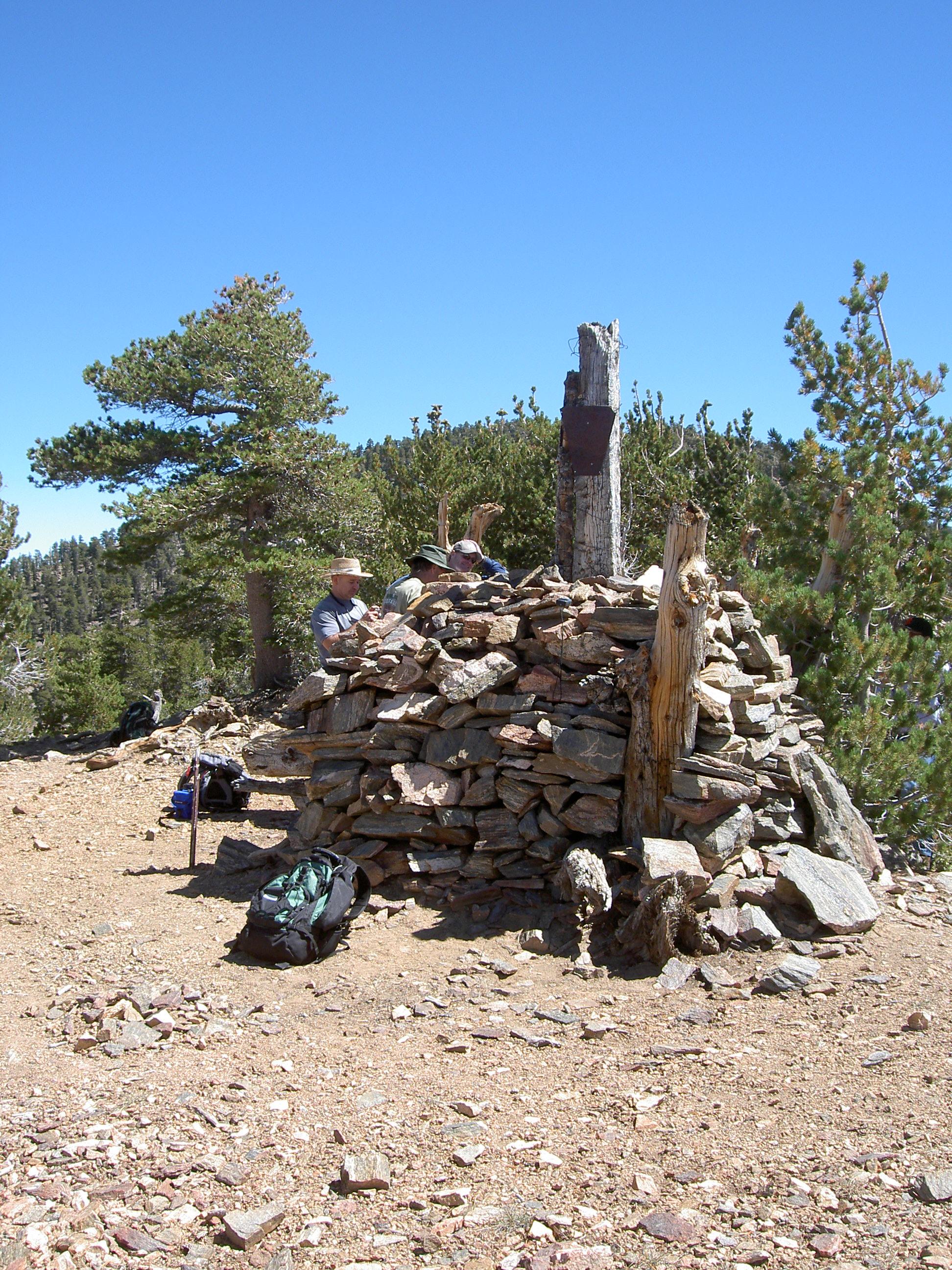
Many pictures were taken and several phone calls
attempted. One time we were crowed around the monument for group
pictures. Our view was to the west. Someone noticed a street on the
valley below that seemed to point directly at us and asked: What street
is that”? I promptly answered “Baseline” and said it continued all the
way to Santa Monica on the coast.
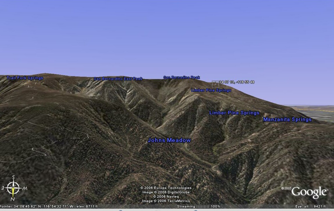
A few of us proceeded due east to the 1907 Pearson
monument along the very steep (down to our right) slope for 600 feet. A
pole had been added in recent years to make it findable. Again pictures
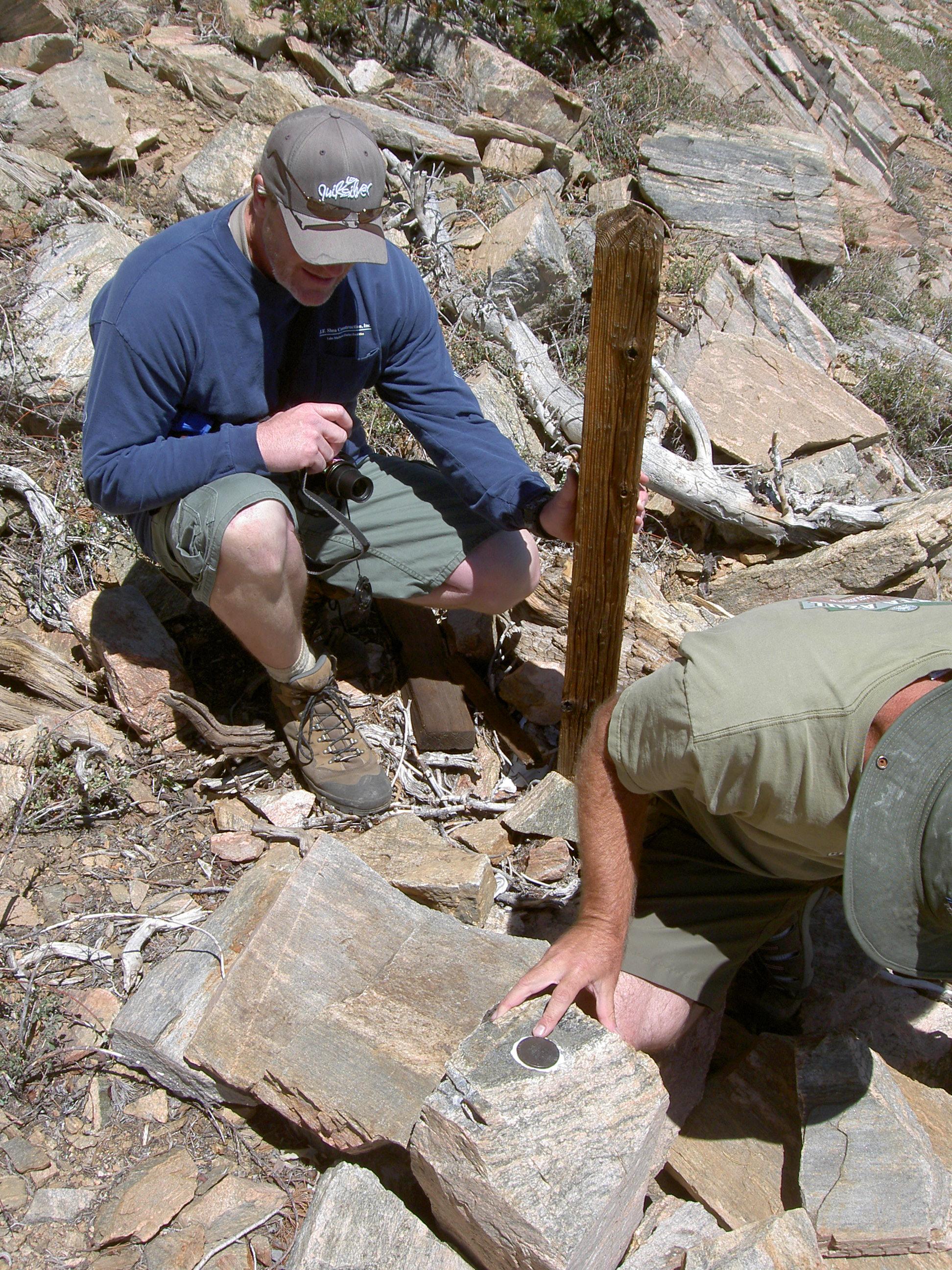
and GPS readings were taken. Then 300 feet more to the east to the 1892
Rice monument for pictures. The original pole is engraved with township
numbers and a pipe had been added years later. Finally, a slow climb up
(>50%) slope to the trail on the ridge and a return the Washington
Monument.
It's all downhill from here and we all made it back
to the trailhead. I confirmed that, on average, our hike was level.
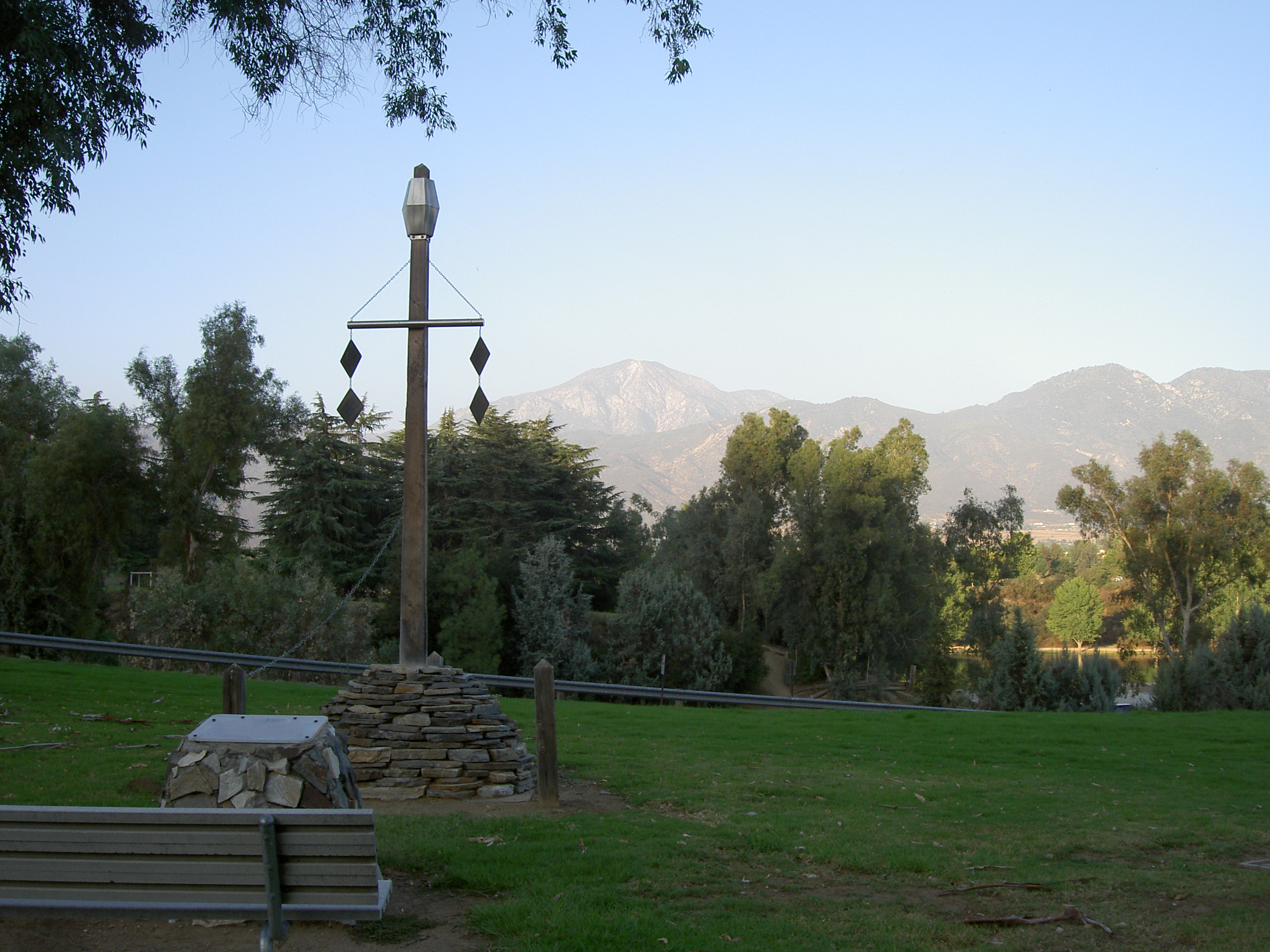
Then, while carpooling back to the ranger station, Mike mentioned that a
model of the Washington Monument had been constructed a few years ago in
the Yucaipa Regional Park. I proceeded to that location and
photographed it as well. It is approximately one-third the size, but
reflects the monument as portrayed in Colonel Washington's diagram.
Thanks again to Ted Elzinga, Mike Duffy and his
staff, and John Shankland.
Gene Holmerud
September 16, 2007
|