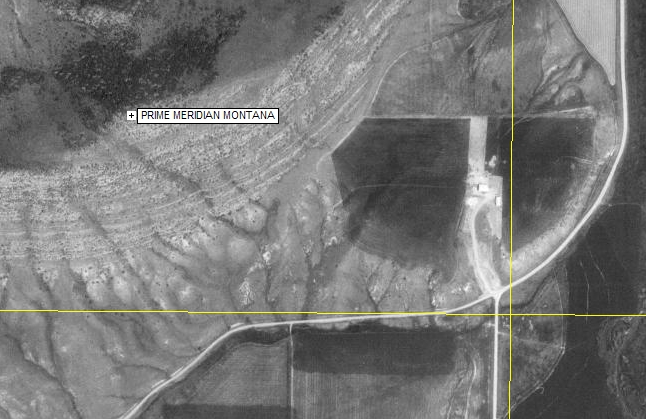
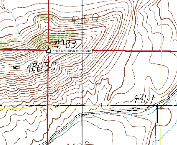
Principal Meridian of Montana
Willow Creek, MT

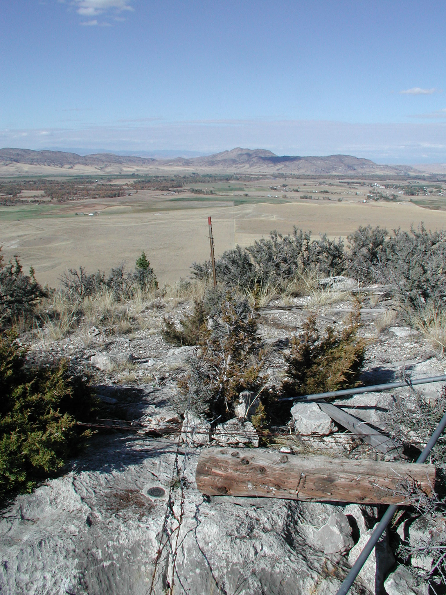
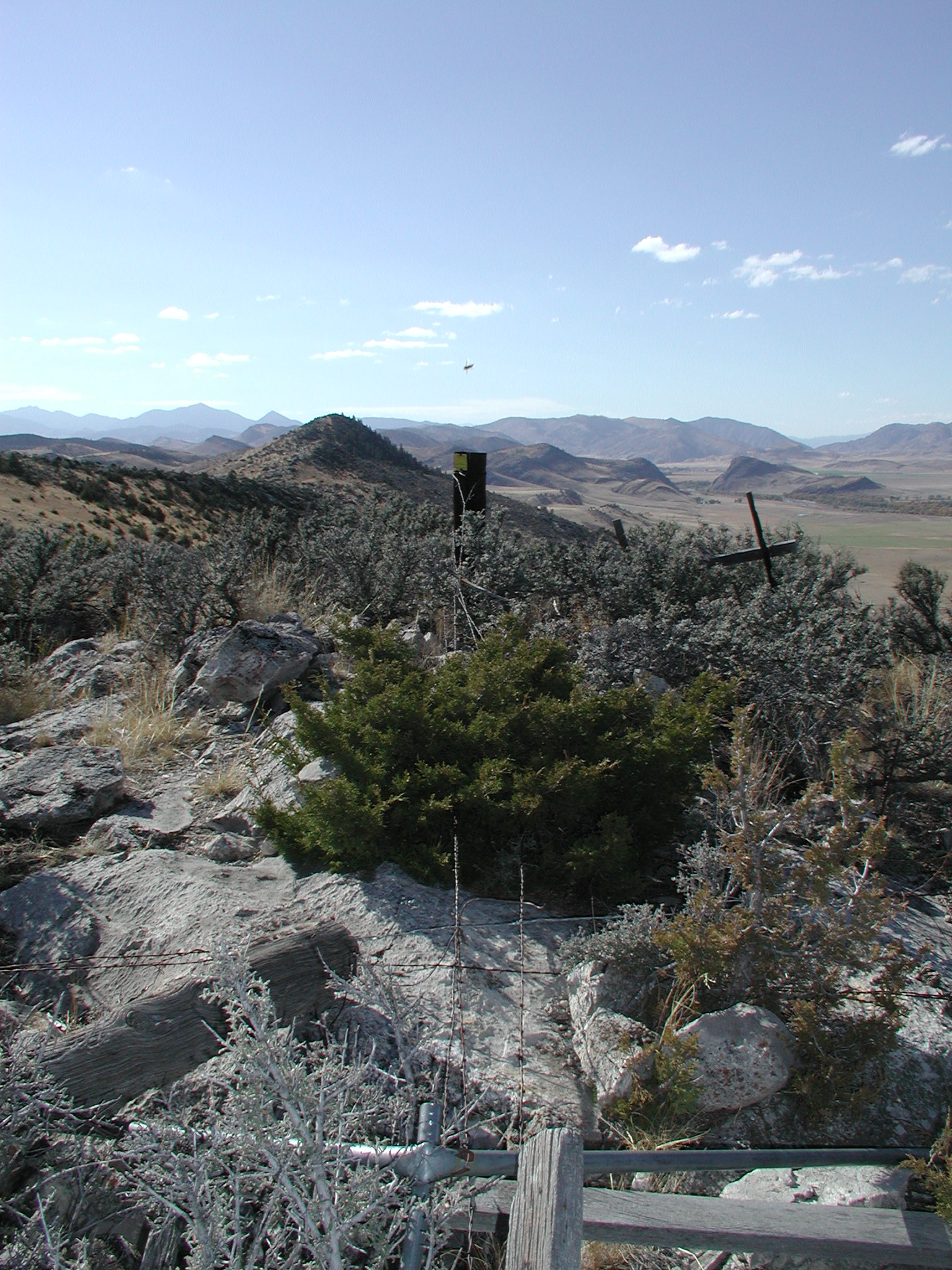
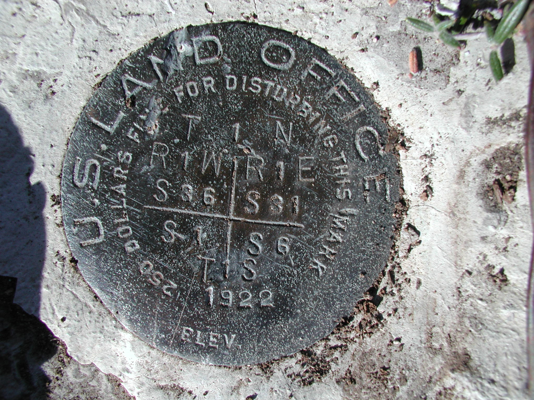
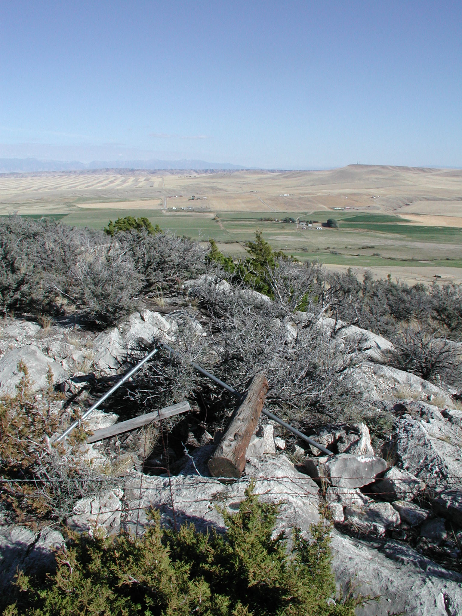
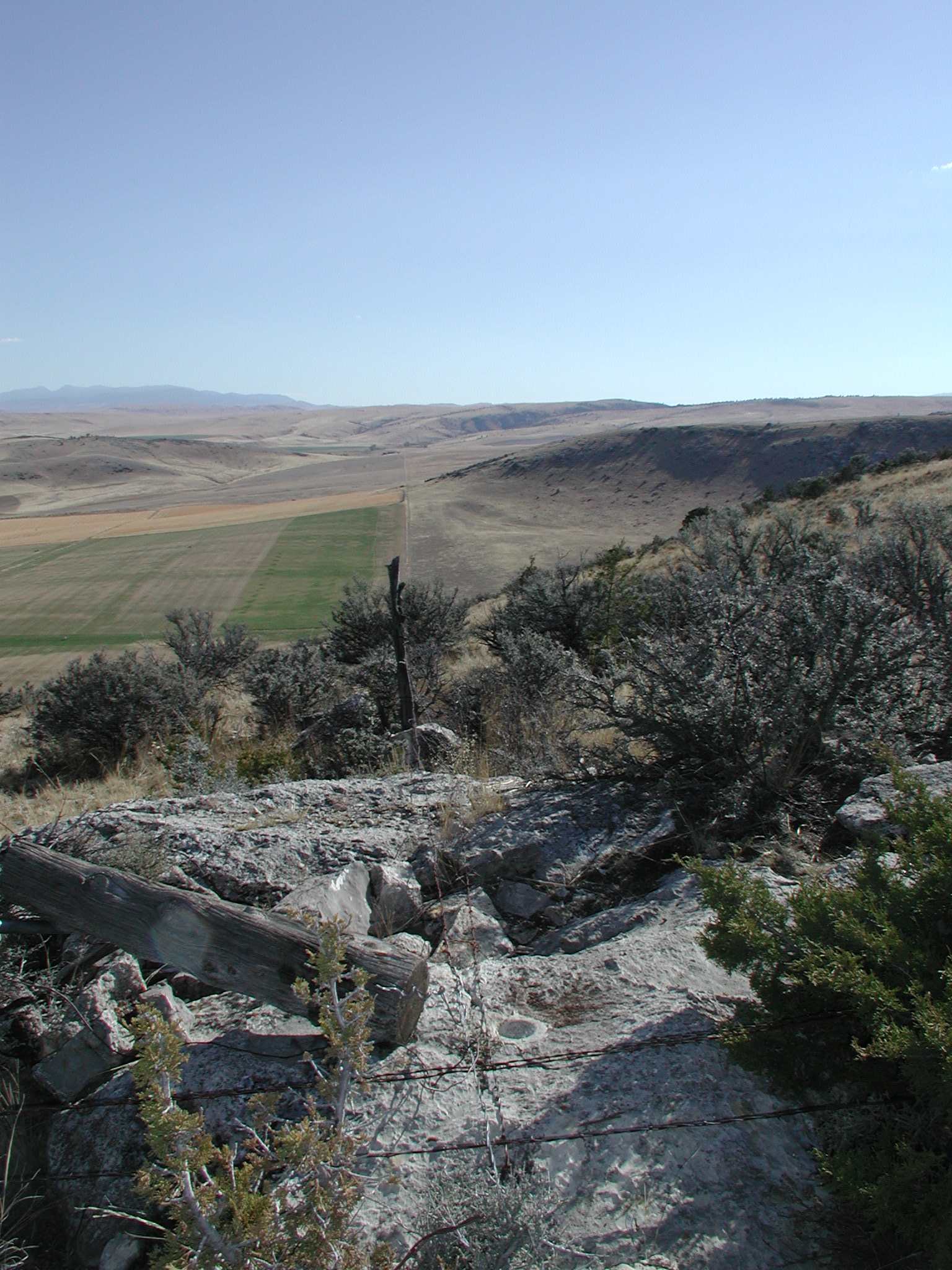
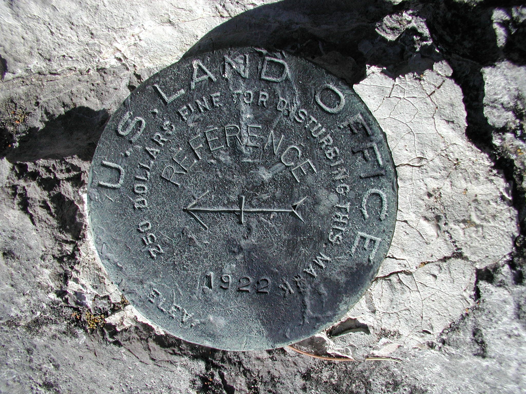
The present corner was set in 1922 by the General Land Office in conjunction with the Coast and Geodetic Survey's Triangulation work throughout Montana. The brass cap was set in the position of an "X" scribed in the limestone ledge on the original survey in 1867. There are reference monument brass caps set approximately 10' north and 21' east from the Initial Point.

This is the only meridian in the U.S. which did not get a number or name, thus the use of Prime Meridian Montana.


Home Page

Submitted by:

Kurt A Luebke


IP North.JPG (694619 bytes)

IPWest.JPG (685345 bytes)

InitialPt1.JPG (700762 bytes)

IP East.JPG (703546 bytes)

IPSouth.JPG (691159 bytes)

IP From the Bottom.JPG (705678 bytes) InitialPtRM1.JPG (725468 bytes) InitialPtRM2.JPG (700572 bytes)
PM located at the top of this hill Reference Mark 1 Reference Mark 2

PMM aerial.jpg (192067 bytes)

topo.jpg (351575 bytes)

This corner can be reached by driving a couple miles south from Willow Creek, Montana on the Old Yellowstone Trail Road. The corner must be reached by crossing private land, permission should be requested before approaching from the South. I parked on the Old Yellowstone Trail Road and hiked due North 0.35 miles; this approach is a little steep and has many rocky ledges to climb up. The view is great in all directions.